One of the first rules about reading topographical maps and navigating in the mountains is to remember that man made features on a map can be incorrect. BUT natural features seldom lie.
So paths, roads, buildings, bridges etc. can be misplaced or are not shown, or did exist at the time the map was made, but are now gone. It is important not to rely on man made objects! It is for this reason that many people go wrong when navigating. The way to pinpoint your position, is to interpret the natural features of the map and then see where you are. Map makers tend to get natural features such as ridges hills, lakes and rivers, incorrect. Lakes and (man made) dams are set out correctly and they can easily be identified on the ground by their size and shape.
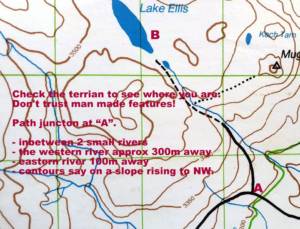
An example is shown in the first map of Lake Ellis (Mt. Kenya). If hiking to Lake Ellis and arriving at the path junction ‘A” and you are wanting to go to point “B”. One does not know if there are in fact two paths in this area or if you are at the correct junction. Or does the path to point “B’ actually exist? The way to tell is to firstly read the contour lines.
– The path is on a gentle NW slope (CHECK)
– In between two small rivers. On a 1:50 000 scale map the one river is about 100m, (2mm) away the other about 300m, ( 6mm) away (CHECK).
These are some of the ways to to check position, but it all takes practice.
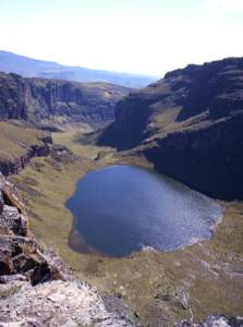
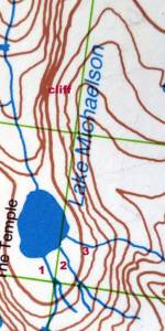
In the other examples below, see how a lake is shown on the map and on the ground and the cliff in the distance is also shown correctly. Compare this to the man made feature discrepancies on the other examples.
To learn these skills and more take a MDT Mountain Leader or Walking Group Leader course contact: gavin@peakhigh.co.za


